PDF3D ReportGen and PDF3D.IO development SDK can be used to convert geospatial formats to 2D or 3D PDF.
Geospatial coordinates are preserved and may be shown in Adobe Reader. The menu for geospatial measurement is not normally displayed by default, here are the steps to show it:
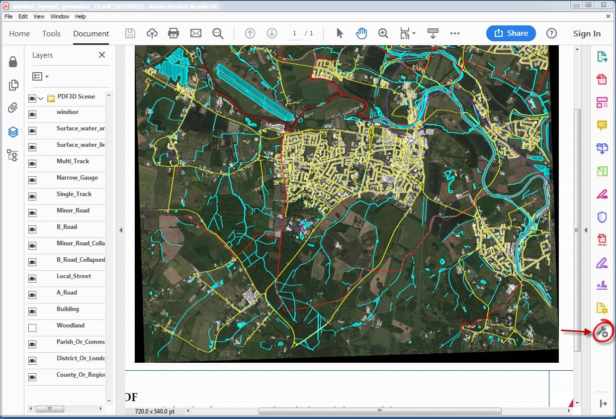
- Load a 2D Geospatial PDF (containing geospatial coordinate data).
- On Right-side tools icon list, hit the “More Tools…” icon.
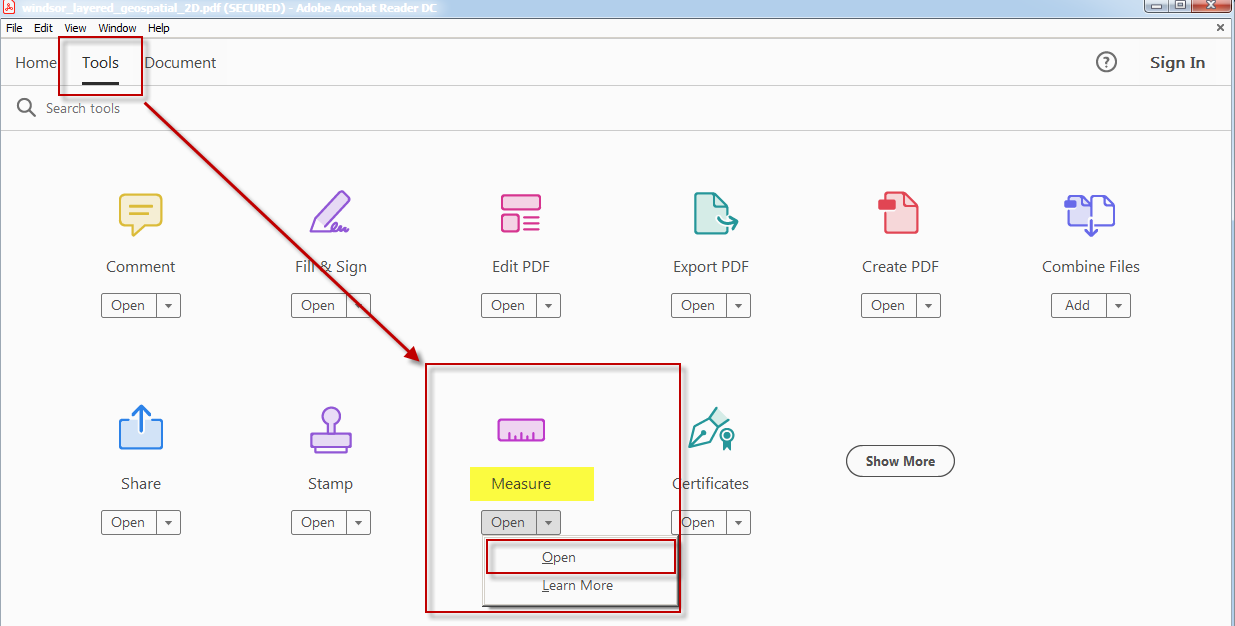
- On the full tools menu, select “Measure”
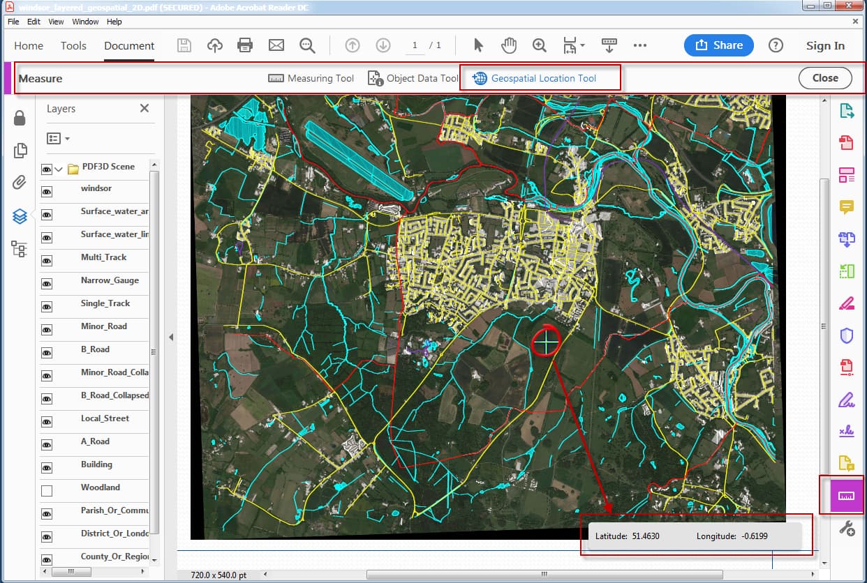
- Above the main PDF viewing area, there are three new types, select “Geospatial” option.
- Put mouse over geospatial data area, it should change shape to a cross.
- Look at lower right area, Latitude and Longitude should be displayed.