PDF3D ReportGen and PDF3D.IO development SDK can be used to convert geospatial formats, such as ArcGIS ASCII grid files, to 2D or 3D PDF.
To convert a typical 1800x1800 tile, please follow these steps for a good 3D PDF :
- Load your desired input file and set a suitable output path for your PDF
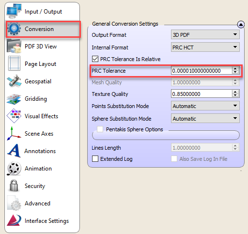
- In case of PRC-HCT compression type, set 0.00001 as PRC tolerance, to reduce depth numerical truncation
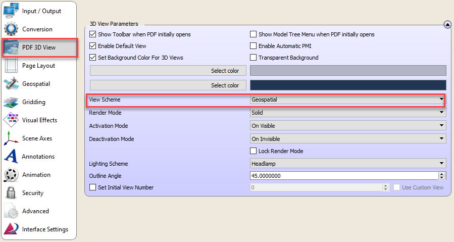
- set View Scheme to Geospatial, to get North Compass and improved default views
-
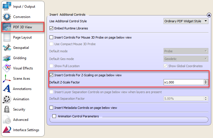
set Insert Controls for Z Scaling, leave default value at 1.0
-
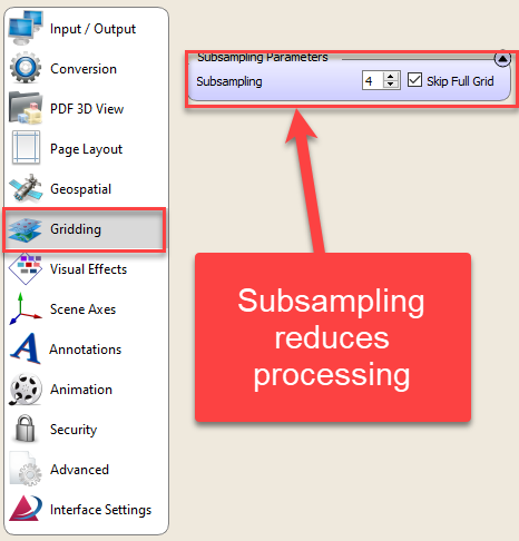
Set Subsampling to 4 (to load every 4th row and column) and Select Skip Full Grid (to reduced texture memory overheads)
- Under Geospatial controls:
- set degree to meter conversion factor to 0.0003 (to make visual exaggeration of depth variations)
- Select Degrees as XY Axes Unit (as ArcGIS XY units are in Lat-Lon decimal degrees)